Regional Overview - Central Scotian Margin
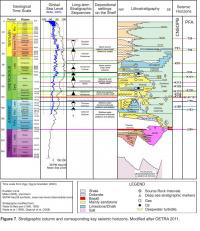
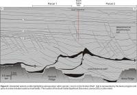
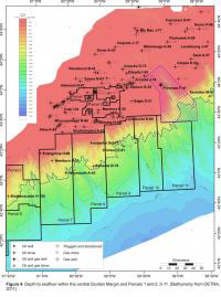 Rifting of the Scotian Margin began in the Middle Triassic and continued into the Early Jurassic forming a widespread region of horsts and grabens throughout the central Scotian Margin (Figure 5). One large and laterally continuous basement horst, the Missisauga Ridge separates two formally defined subbasins, the Abenaki and Sable Subbasins. The Abenaki Subbasin is bounded to the north and west by the LaHave Platform and to the south by the Missisauga Ridge (Figures 5 and 6). South of the Missisauga ridge is the Sable Subbasin which extends across the present day shelf and into deep water. Numerous basement highs have been identified within the Sable Subbasin. The Alma Ridge is a large basement horst located slightly landward of the present day shelf break, and between these, two other smaller horsts have been identified: the Venture and Migrant Ridges (Figures 5 and 6). Following the convention established by previous workers on the margin (i.e. Jansa and Wade 1975), these features are named after the wells drilled above them. A representative seismic line through the central Scotian Margin, intersecting both Subbasins and the smaller intervening basement highs is presented in figure 6 and a stratigraphic column displaying the seismic horizons mapped on figure 6 is presented in figure 7.
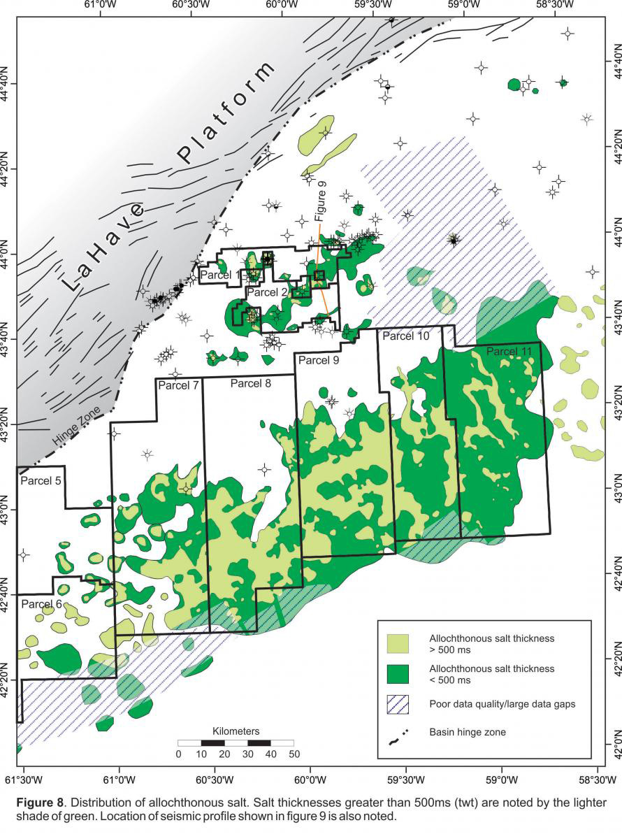
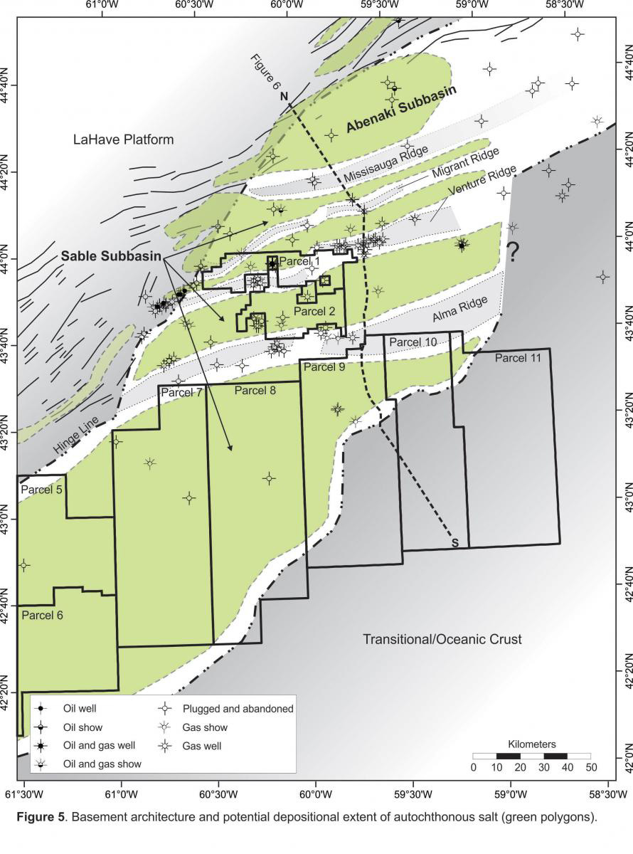 Autochthonous salt deposition on the Scotian Margin is interpreted to be synrift and was potentially bounded by basement highs (Figure 5). A recent research focus by the CNSOPB has been to improve the understanding of the history and influence of salt tectonics within the central Scotian Margin, this work resulted in a detailed map of allochthonous salt presence (Figure 8). One of the main conclusions from this study is that basement highs were influential in focusing the early uprising of allochthonous salt bodies. Sediment loading and downbuilding by Early Jurassic systems loaded the salt which was often pinned in the basinward direction by basement highs (i.e. Migrant, Venture and Alma ridges). Salt contact with these basement horsts forced the salt to climb vertically through the sedimentary section eventually forming either solitary salt diapirs or canopies (Figure 9). The influence of basement structure on the evacuating salt is believed to be reflected in the southwest-northeast trend of both the shelf canopy and the larger allochthonous canopy in deepwater which parallels the underlying trend of basement highs.
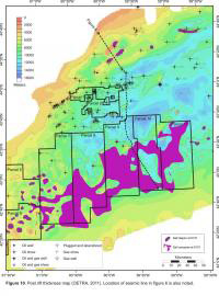
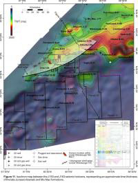
 A post rift thickness map of the central Scotian Margin illustrates there is approximately 14 km of sediments in the northern portion of Parcel 10. Other post rift thicks are visible east of this location, but the post rift section generally thins westward towards Parcels 5, 6 and 7. (Figure 10) (OETRA, 2011). The Early Jurassic Mohican Formation is the initial post rift fill in the Scotian Basin; it consists of texturally immature siltstones, fine grained sandstones and red-brown and green shales (Given, 1977). Following the deposition of the Mohican in the Middle and Late Jurassic there was an influx of siliciclastics of the Mic Mac Formation and coeveal limestone deposits of the Abenaki Formation (Wade and Maclean, 1990). Figure 11 is a time thickness map of the mid to late Jurassic section (J150 to J163) and represents the depositional extent of the Mic Mac delta within the central Scotian Margin. Aside from one localised thick deposited in deep water southwest of the Chebucto K-90 well, these thick Mic Mac deposits are confined to the present day shelf. The thick trend of deltaic Mic Mac deposits on the shelf extends into Parcels 1 and 2 and exploratory wells that have penetrated this sequence on the shelf have encountered reservoir quality sandstones. The West Venture, Uniacke, Citnalta and Arcadia gas fields are all Significant Discoveries with considerable gas pay in the Mic Mac Formation. In addition, three of the SOEP fields (South Venture, Venture and Thebaud) have all produced gas from the Mic Mac Formation (see figure 30 for location of SDL’s and producing fields). Overlying the isochron in figure 11 is the Berriasian/Valanginian shelf break trajectory which is the shelf break location post Mic Mac deposition. This shelf edge, which was identified by mapping numerous lower Missisauga canyon incisions (see the Sediment Delivery section) corresponds to the basinward edge of the underlying Mic Mac deposits.
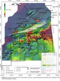
 The Missisauga Formation was deposited throughout the Late Jurassic and Early Cretaceous. This sand rich sequence of fluvial deltaics can be divided into upper and lower members which are separated by an interval of generally thin Hauterivian/Barremian oolitic limestones, the “O” Marker. Thick deposits of lower Missisauga sediments (K130-J150) are located basinward of the underlying Mic Mac delta system (Figure 12). A southwest-northeast trending lower Missisauga thick extends through parcel 2 and also lies within the southern portion of parcel 1. A number of wells such as those drilled in the West Venture, Citnalta, Olympia, West Olympia, Intrepid and Glenelg Significant Discoveries have encountered considerable reservoir quality sandstone and net gas pay in the Lower Missisauga. There are also three fields within the Sable Offshore Energy Project that are currently producing gas from the Lower Missisauga: Thebaud, Venture and South Venture (see figure 30 for location of SDLs and producing fields).
 Projecting both the Valanginian and Barremian shelf edge trajectories onto the isochron in figure 12 shows the advance of these early Cretaceous systems. The Barremian shelf edge correlates well with the basinward limit of the underlying lower Missisauga thick on the shelf. The time-thickness map of the lower Missisauga in figure 12 also illustrates thick turbidite deposits may be present in the northern parts of Parcels 7-11. Canyon incisions within the Lower Missisauga are the likely source for delivering these sediments to deep water. The lower Missisauga thicks in present day deep water were likely in an upper slope position during the Early Cretaceous and turbidites were ponded in this position while loading the proximal edge of the deepwater allochthonous salt canopy; this is particularly evident within Parcels 9, 10 and 11. This Early Cretaceous salt loading in deepwater resulted in multiple inverted minibasins and other salt influenced structures.
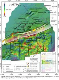
 The Upper Missisauga and Logan Canyon formations prograded further basinward placing the Upper Missisauga shelf margin in the southern part of Parcel 2 and a Logan Canyon shelf margin into the northern extent of Parcels 7-10. A cumulative time thickness map of both the Upper Missisauga and the Logan Canyon formations (K78-K130) is shown in figure 13. Overlaying the Barremian, Aptian/Albian and Albian/Cenomanian shelf edges on this isochron displays the progradational advance of the margin while depositing the Upper Missisauga and Logan Canyon. Significant Discoveries that have encountered hydrocarbons, on the shelf, in the Upper Missisauga and Logan Canyon Formations include West Sable (oil and gas), South Sable (gas), Intrepid (gas), Onondaga (gas), Glenelg (gas) and Chebucto (gas). There are also three SOEP fields that are currently producing gas from the Upper Missisauga: Thebaud, North Triumph and Alma.
 This isochron in figure 13 also illustrates there were significant thicknesses of Upper Missisauga and Logan Canyon sediments deposited in deep water. Canyon incisions within the Upper Missisauga Formation and above the Naskapi member would have delivered sediment to deep water during this period. These turbidite deposits are in the southern portions of parcels 7-11 where they were loading an extensive canopy system throughout the Aptian to Cenomanian. The canopy loading during this period resulted in numerous turtle structures (see lead map). Also noteworthy on this isochron is the thinning trend of this sequence along the northern portion of parcels 7-11 between the Balvenie B-79 and Annapolis G-24 wells. This trend of thin deposits is due to a series of salt highs that are present during this time period that resulted in sediments bypassing this area.
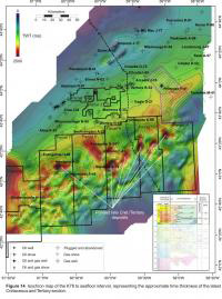
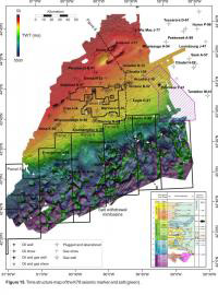
 A time-thickness map of the late Cretaceous to present (K78 - seafloor) illustrates that a broad zone of thick deposits extends farther back onto the present day shelf than many of the previous sequences (Figure 14). Shelf margins during this period are believed to be transgressing and are located on the present day shelf. However, the isochron in figure 14 illustrates that Tertiary aged turbidites were deposited in deep water. The trend of thicks through the central and northern portions of parcels 7-11 are interpreted to be ponded Late Cretaceous and Tertiary turbidites within salt withdrawal minibasins. These minibasins formed by loading the trend of salt highs that are evident in figure 13. A time structure map of the K78 seismic horizon clearly defines the locations of these salt withdrawal minibasins (Figure 15).
