Regional Overview - Western Scotian Margin
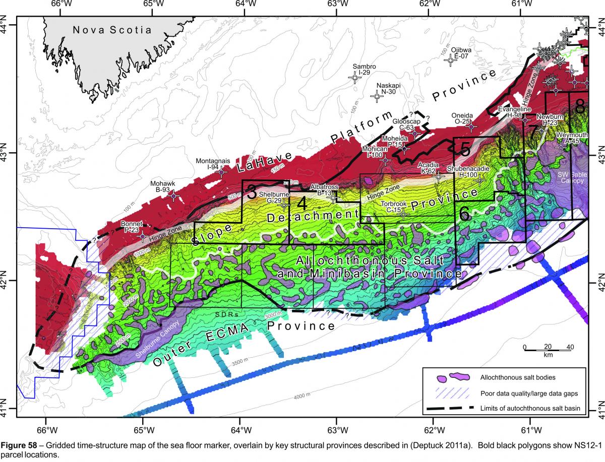
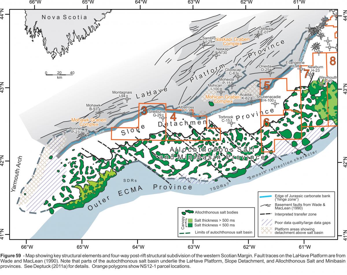
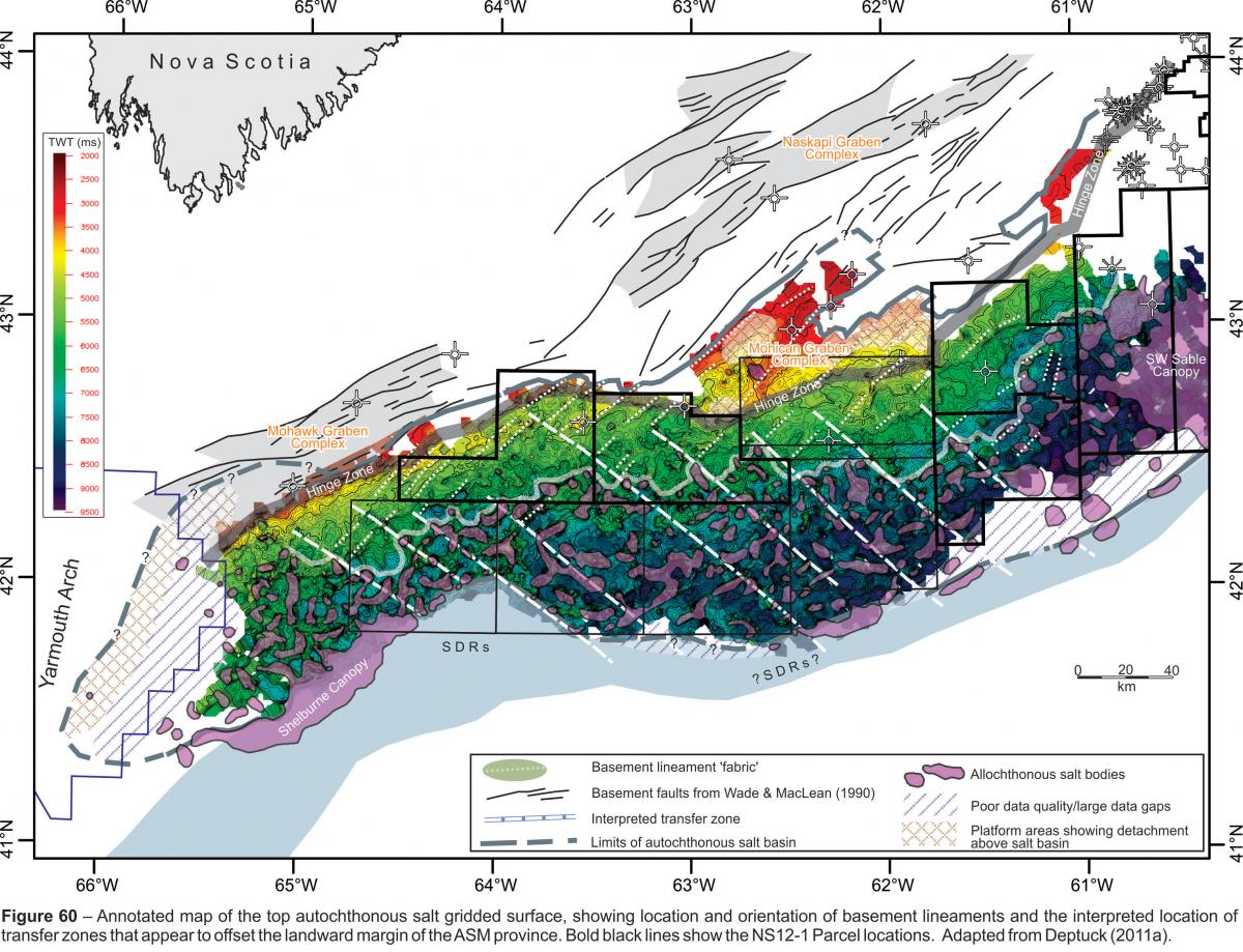
 The western Scotian Margin includes areas of the modern shelf, slope, and rise located west of the Sable Subbasin, and is underlain in part by a Late Triassic to Early Jurassic primary salt basin that formed as Nova Scotia rifted and ultimately broke apart from its Moroccan conjugate. The western Scotian Margin can be subdivided into four proximal to distal postrift structural provinces, from landward to seaward referred to as the LaHave Platform (LP), Slope Detachment (SD), Allochthonous Salt and Minibasin (ASM), and Outer East Coast Magnetic Anomaly (ECMA) provinces (Figures 2, 3, 59). All four structural provinces were influenced to varying degrees by salt tectonics and the pre-breakup configuration of the margin, including the original thickness distribution of salt, probably played an important role in the style of deformation and the resulting types of structures that developed during later passive margin subsidence. The thickest salt probably accumulated in the area of greatest rift-accommodation interpreted to lie directly below the ASM province (Deptuck, 2011a). The original salt basin may have been segmented across numerous northwest to southeast trending synrift transfer zones in this region, and localized salt depocenters probably also formed, for example, in the Mohican Graben Complex that straddles the LP and SD provinces (Figures 59, 60). At a more local scale, original salt thickness probably also varies over distances of a few kilometers, thinning for example above horst blocks and other northeast-trending positive-relieve basement elements that underlie much of the LP, SD, and ASM provinces (e.g. figure 9 in Deptuck, 2011a).
 In addition to the amount and distribution of synrift salt, the structural style in each of the four structural provinces is interpreted to reflect regional patterns in the postrift subsidence history. The LP province, which is only partially underlain by the autochthonous salt basin, formed a relatively stable platform that experienced generally slow postrift subsidence rates. In contrast, postrift subsidence probably increased significantly seaward of the margin hinge-zone (Figure 59) resulting in a seaward tilt of the SD province and causing widespread thin-skinned detachment and raft tectonics (Deptuck, 2010, 2011a). Some salt may also have flowed seaward during early postrift subsidence, enhancing the early expulsion of salt from the SD province and further increasing the salt thickness in the ASM province (Albertz et al., 2010). In contrast to the SD province, more uniform subsidence is envisioned for the ASM province, where down-building was localized within minibasins as salt was expelled into generally vertical salt diapirs and walls.
 This proximal to distal structural subdivision provides useful geological context for the four westernmost parcels in the NS12-1 Call-for-Bids (Parcels 3, 4, 5, and 6; Figures 58, 59). Parcels 3, 4, and 5 straddle to LP, SD, and ASM provinces, whereas parcel 6 is located principally above the ASM province. The reader is directed to Deptuck (2011a) for a more detailed description of each of these provinces.
*NOTE: The parcel configuration for the four western parcels in the NS12-1 Call-for-Bids (Figures 58, 59, 60) is different from the configuration in the NS11-1 Call-for-Bids (presented, for example, in Deptuck, 2011a) and the NS08-2 Call-for-Bids where additional geoscience information can be found.