Potential Reservoirs and Traps
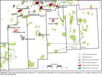 The CNSOPB has identified a number of undrilled prospects with considerable hydrocarbon potential on Parcels 7-11. These undrilled structures are numbered 8-13 on figure 52. It should be noted that other prospects are likely present on the parcels which further seismic mapping may uncover. These prospects may include plays such as stratigraphic traps and additional salt flank and subsalt plays that may arise with access to higher quality seismic data. The mapped prospects on Parcels 7-11 have between 10 - 200 km2 of closure. There are several prospects with over 70 km2 of closure that have the potential to contain between 7 - 19 Tcf of gas in-place. The majority of play types within these parcels are Cretaceous and Tertiary deepwater turbidite deposits that interact with salt. A selection of the prospects are discussed below.
NS08-2 Structures (8)
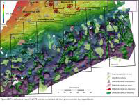 A suite of salt related structures were identified throughout parcels 5, 6 and 7 for the NS08-2 call for bids package (Figure 51). The structures shown are Fryingpan, Liscomb, Little Punk, Piscatiqui, Seawolf, Big Thrum, Sandy Point, Big Tancook, Crows Neck, Cape LaHave and Tusket. A potential stratigraphic trap, Bella, is also identified. Please refer to the NS08-2 call for bids package for information about these potential exploration targets. Specifically figures 22a-27 for information on the above leads.
Structures related to the Balvenie Roho System (Structure 9)
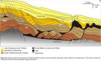 Parcel 8 is dominated by structures related to the Balvenie Roho System (Figure 53). At least two sub salt-detachment turtle structures are noted (features labeled 9 on figure 54). These lower Missisauga and Jurassic(?) turtle structures formed between the diapirs that sourced salt to the overlying detachment. There are also numerous other opportunities for subsalt plays beneath the salt canopy and faulted traps within the overlying detached Cretaceous strata.
Belleisle (10)
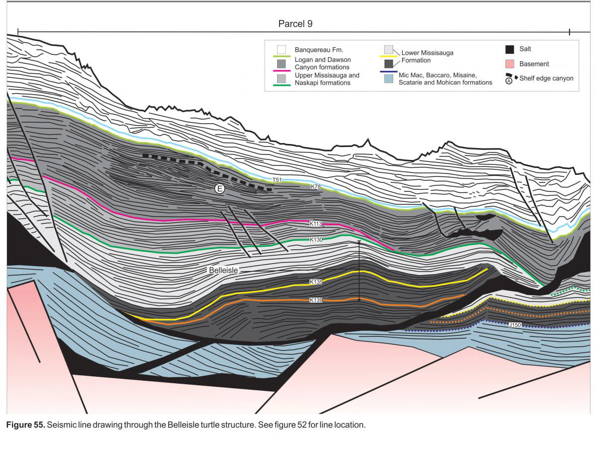 The Belleisle structure consists of inverted Lower Missisauga strata. This structure is due east of the Annapolis and Crimson wells and the target interval is stratigraphically deeper than what was encountered within these wells. Figure 12 shows that this structure is located within the east-west trending thick of Lower Missisauga deposits that crosses through the northern section of parcels 7-11. The location of this structure within the thick Lower Missisauga trend increases the probability of encountering a higher net to gross interval.
Granville (11)
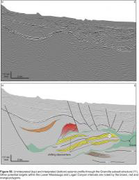 Figure 56 is an un-interpreted and interpreted seismic line through the Granville structure (11) and at least three other exploration targets are also available on this line. This is a complicated region of the slope where multiple seaward leaning salt feeders and their respective tongues are merging to form a salt canopy. The Granville structure consists of Upper and Lower Missisauga strata that have been thrusted basinward on an underlying salt surface. Shifting depocenters are visible within this interval and at least one of these thickening packages (yellow polygons) is in contact with the overlying salt canopy, which may be providing an effective seal to migrating hydrocarbons. Deeper in the seismic section, below the Granville structure, there is potential for another subsalt structure within the Lower Missisauga strata (brown polygon). Within the overlying Aptian and Albian interval, ponded deposits within the Logan Canyon Formation have either been detached downslope and are now up on structure or have been rotated landward leading to at least two other potential targets on this profile (orange and red polygons).
Thorburn (12)
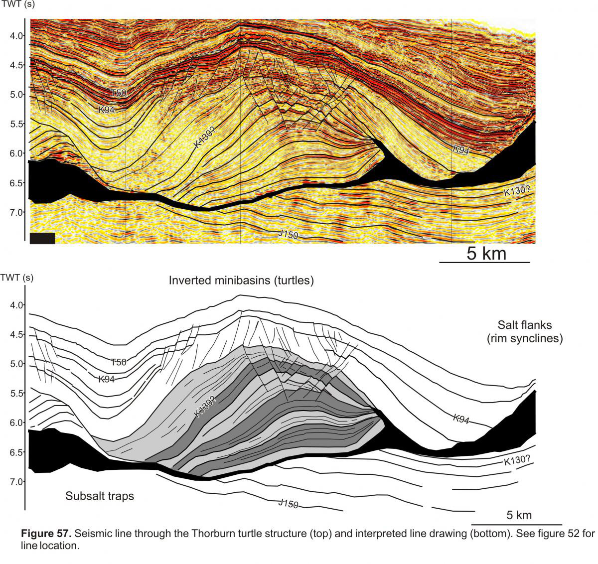 The Thorburn turtle structure is located within parcel 11 and is series of inverted thicks consisting of both Upper and Lower Missisauga strata (Figure 57). As with the Belleisle structure, Thorburn also lies within the thick deposits of Lower Missisauga strata that trends through the northern section of parcels 7-11 (Figure 12). With significant structural relief and a large area under closure (up to 80 km2) this structure could potentially hold upwards of 4-5 Tcf of gas. There is also subsalt potential beneath this structure.
Canopy Loading Turtle Structures (13)
There are numerous (at least 14 identified) turtle structures that formed as the result of loading the allochthonous salt canopy. Turbidite deposits of Upper Missisauga and Logan Canyon sediments loaded the distal part of the canopy throughout the Barremian to Cenomanian forming widespread turtle structures (Figure 13). One of these turtles within the southern part of parcel 10 has a potential maximum area under simple closure of 150 km2 (mapping based on 2D seismic).
All the parcels on the Scotian Slope also have the potential for stratigraphic traps within ponded strata of Late Cretaceous and Tertiary salt withdrawal minibasins. The locations of numerous salt withdrawal minbasins throughout the parcels is noted on figures 14 and 51.