
CANADA-NOVA SCOTIA OFFSHORE PETROLEUM BOARD


Geology
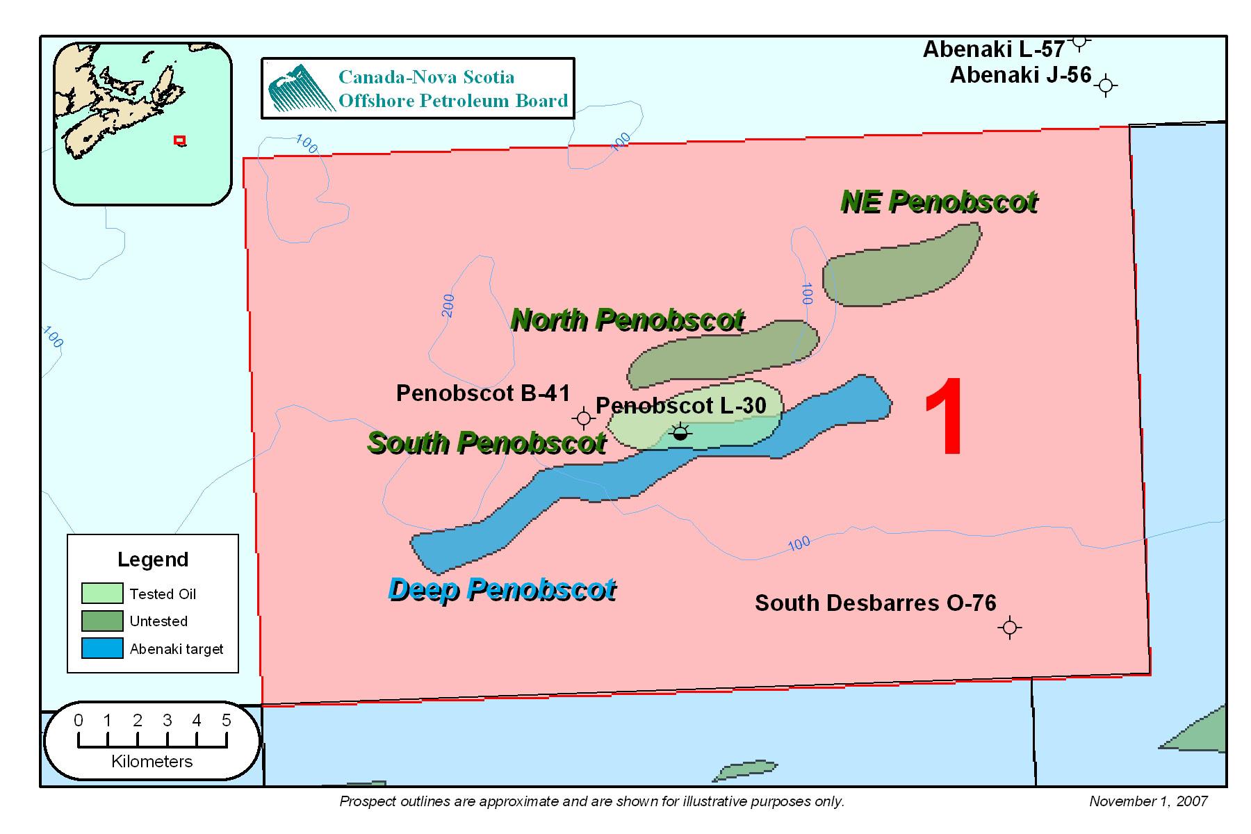
FIGURE: 13
The Penobscot reservoir sands are located below the 'O' limestone marker in the early Cretaceous Missisauga formation. Penobscot L-30 encountered seven hydrocarbon bearing moderate to well sorted, fine to coarse grained reservoir sands. The interpreted environment of deposition for these reservoirs varies from distributary channel to shoreface. The sands vary in thickness from a few metres to over 70 m and can be correlated, with varying degrees of confidence, between Penobscot L-30 and Penobscot B-41, located 3.2 km to the west. Penobscot B-41 was drilled on a "satellite" structure, separated from the L-30 closure by a structural saddle, and did not encounter hydrocarbons. In general, the thicker shoreface sands can be correlated with higher confidence and are interpreted to have the greatest lateral continuity, see Figure 15.
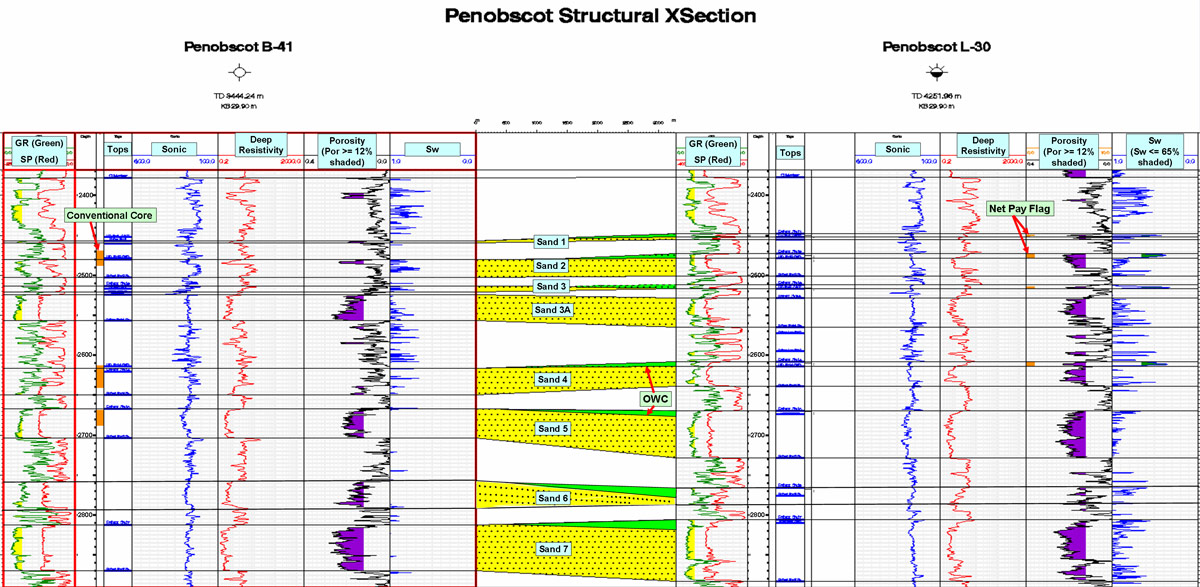
FIGURE: 15
The Penobscot field can be subdivided into two reservoir regions. The reservoir region south of the main Penobscot fault containing the L-30 well, which recovered oil and gas from several zones and two separate untested accumulations located to the north and northeast, as shown in Figure 13. The reservoirs encountered in the southern region, are interpreted to be trapped in a 4-way dip closure created on the downthrown side of a down-to-the-basin growth fault, i.e. rollover anticline. The northern accumulation, on the upthrown side of the main Penobscot fault, is a 3-way fault dependent closure. The northeastern accumulation is primarily trapped in a 3-way fault dependent closure, however some simple closure is also present. Top seal for the above zones is provided by the overlying marine shales.
The Verrill Canyon shales are believed to be the source rock for the Penobscot structure. The main fault system exhibits evidence of early movement within the Jurassic period. This early movement may have created a conduit for the migration of generated hydrocarbon fluids into the system. In Penobscot L-30, the top of the Verrill Canyon shales (-3666.7 m) is near the top of the oil window (Clack and Crane, 1992).
Clack, W.J.F, Crane, J.D.T, 1992.
Penobscot Prospect: Geological evaluation and oil reserve estimates. Report for Nova Scotia Resources (Ventures) Ltd.