Study area, data-set and approach
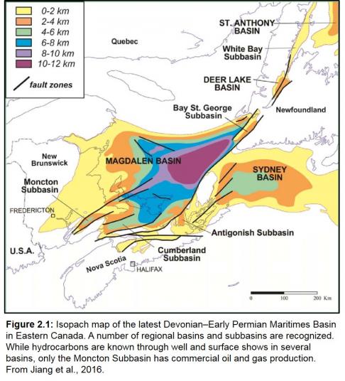
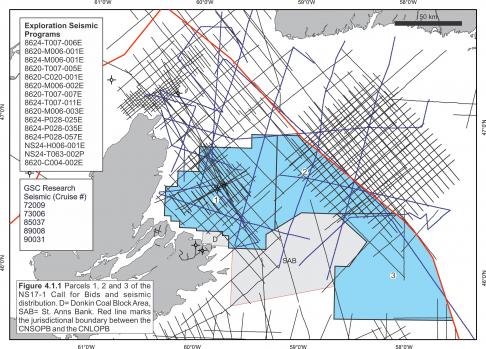
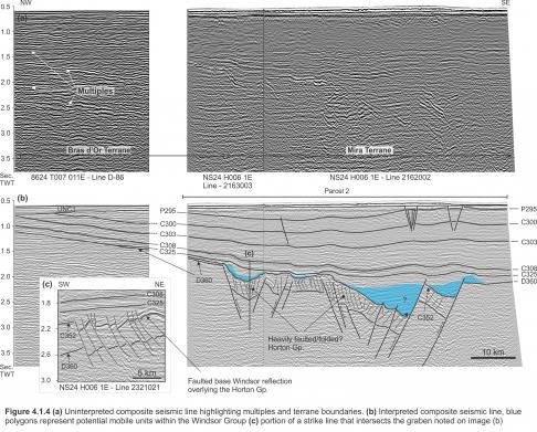
The study area for Call for Bids NS17-1 covers the Sydney Basin and the easternmost portion of the Magdalen Basin. Collectively, these two areas form the eastern extension of the Maritimes Basin (Figure 2.1). An extensive suite of 2D seismic surveys, varying greatly in vintage and quality, forms the main data-set for this study (Figure 4.1.1). The most recently acquired seismic available in the database is the NS24-H6-1E survey, collected by Husky in 2010. All other surveys were collected in the 1980’s or earlier. To varying degrees, seismic imaging and artefacts like conventional seafloor and peg-leg multiples present a significant interpretation challenge, in some cases forming the dominant reflections and substantially obscuring primary reflections (e.g. Figure 4.1.4). Substantially improved imaging in the 2010 Husky survey provided a higher degree of interpretation confidence, helping guide interpretations in poorer data-quality areas. In addition, different seabed multiple and peg-leg scenarios were calculated and overlain on seismic sections as seismic markers were correlated, in an attempt to minimize interpretation errors associated with seismic artefacts. Shallow high-resolution seismic profiles (available from the Geological Survey of Canada) were also vectorized and used to determine the dip of folded primary reflections in the upper 100 m or so. These profiles helped to confirm the dips of folded strata in areas where poor resolution or near-seabed ringing in conventional industry data obscured the recognition of primary reflections. In some areas these shallow penetrating profiles helped to clearly distinguish higher amplitude layer-cake artefacts on industry profiles, from folded dipping and erosionally truncated Carboniferous and/or Permian strata. Unfortunately, failure to recognize these artefacts has lead to erroneous interpretations in a number of previous studies (discussed later). In addition to the myriad of seismic artefacts, data gaps of 10 km or more are common in the central and southern portions of the study area.
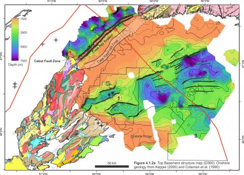
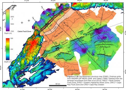
Synthetic seismograms were generated for five wells, Birch Grove No.1, North Sydney P-05, North Sydney F-24, St. Paul P-91 and CCS Nova Scotia No. 1. These wells provide calibration of the seismic stratigraphy, but the calibration is limited to the western and nearshore parts of the study area. There are no well penetrations that calibrate strata older than the upper Windsor Group (discussed in more detail later). Significant efforts were also made to ensure that the shallow offshore geological interpretations are consistent with the stratigraphy exposed along immediately adjacent shorelines on Cape Breton Island and southern Newfoundland (Figure 4.1.2a, b). Several onshore exposures of Mabou and Morien Group strata appear to continue into offshore basins. Likewise, exposed basement terranes in onshore areas were correlated with a moderate degree of confidence into offshore areas, with interpretations bolstered by available gravity and magnetics data-sets, and previously published interpretations (Dehler and Roest, 1998; Barr et al., 2014).
Despite the unique integration of modern topography, surface geology, gravity, magnetics, industry and academic seismic, and information from both onshore and offshore industry boreholes, into a single workstation environment, large data-gaps and extremely poor seismic quality (in particular) lead to a large amount of interpretation uncertainty in some offshore areas. Acquisition of additional modern seismic and other geophysical data-sets will be required to properly evaluate the geology in such areas.


