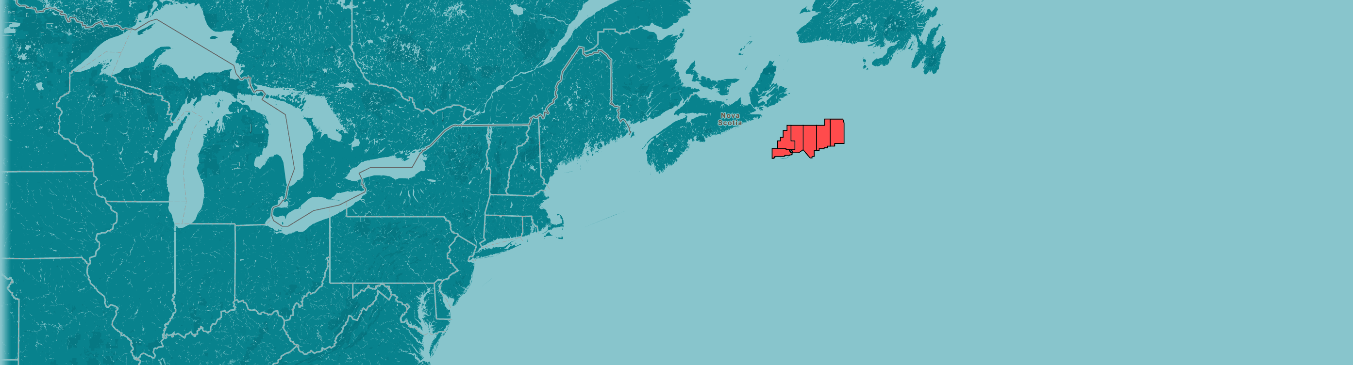
Location and Coordinates
LAND PARCEL NO. 1 – All petroleum substances in all geological formations
|
Grid* |
Hectares |
Sections |
|
44-00-60-15 |
5,565 |
60, 68-70, 78-80, 87-90, 97-100 |
|
44-10-59-30 |
12,593 |
45-47, 54-57, 64-67, 74-80, 83-90, 93-100 |
|
44-10-59-45 |
31,485 |
3-10,13-20, 23-30, 33-40, 43-50, 53-60, 63-70, 72-100 |
|
44-10-60-00 |
37,050 |
1-100 |
|
44-10-60-15 |
37,050 |
1-100 |
|
44-20-59-30 |
1,110 |
91-93 |
|
44-20-59-45 |
14,800 |
1-3, 11-13, 21-23, 31-33, 41-43, 51-55, 61-65,71-75, 81-85, 91-95 |
|
44-20-60-00 |
18,500 |
1-5, 11-15, 21-25, 31-35, 41-45, 51-55, 61-65, 71-75, 81-85, 91-95 |
|
44-20-60-15 |
18,500 |
1-5, 11-15, 21-25, 31-35, 41-45, 51-55, 61-65, 71-75, 81-85, 91-95 |
|
Total Hectares |
(Approximate) |
176,653 |
*NAD 1927
LAND PARCEL NO. 2 – All petroleum substances in all geological formations
|
Grid* |
Hectares |
Sections |
|
44-20-59-15 |
2,585 |
94-100 |
|
44-20-59-30 |
25,850 |
4-10, 14-20, 24-30, 34-40, 44-50, 54-60, 64-70, 74-80, 84-90, 94-100 |
|
44-20-59-45 |
22,150 |
4-10, 14-20, 24-30, 34-40, 44-50, 56-60, 66-70, 76-80, 86-90, 96-100 |
|
44-20-60-00 |
18,450 |
6-10, 16-20, 26-30, 36-40, 46-50, 56-60, 66-70, 76-80, 86-90, 96-100 |
|
44-30-59-15 |
3,685 |
91-100 |
|
44-30-59-30 |
36,850 |
1-100 |
|
44-30-59-45 |
36,850 |
1-100 |
|
44-30-60-00 |
36,850 |
1-100 |
|
44-40-59-30 |
14,696 |
61-100 |
|
44-40-59-45 |
36,740 |
1-100 |
|
44-40-60-00 |
12,865 |
1-7, 11-17, 21-27, 31-37, 41-47 |
|
44-50-59-30 |
14,656 |
61-100 |
|
44-50-59-45 |
36,640 |
1-100 |
|
45-00-59-30 |
14,612 |
61-100 |
|
45-00-59-45 |
10,959 |
1-30 |
|
Total Hectares |
(Approximate) |
324,438 |
*NAD 1927
LAND PARCEL NO. 3 – All petroleum substances in all geological formations.
Parcel 3 includes partial sections, as noted in the table below, which abut the boundary of the Gully Marine Protected Area as defined under Section 2 of the Government of Canada’s Gully Marine Protected Area Regulations (SOR/2004-112). This boundary is defined as a rhumb line connecting point 44°06’N, 59°20’W to point 44°13’N,59°06’W (NAD27 datum).
|
Grid* |
Hectares |
Sections |
|
44-10-59-00 |
555 |
90*,99*,100* *Partial sections |
|
44-10-59-15 |
10,508 |
8*, 9*,10,18*,19-20, 28-30, 38-40, 48-50, 58-60, 68-70, 78-80, 88-90, 98-100 *Partial sections |
|
44-10-59-30 |
3,330 |
8-10,18-20,28-30 |
|
44-20-59-00 |
19,950 |
43*,44-50, 52*, 53*,54-60, 61*, 62*, 63-70, 71*, 72-100 *Partial sections |
|
44-20-59-15 |
34,365 |
1-93 |
|
44-20-59-30 |
5,550 |
1-3, 11-13, 21-23, 31-33, 42-43, 53 |
|
44-30-59-00 |
22,110 |
41-100 |
|
44-30-59-15 |
33,165 |
1-90 |
|
44-40-59-00 |
22,044 |
41-100 |
|
44-40-59-15 |
36,740 |
1-100 |
|
44-40-59-30 |
22,044 |
1-60 |
|
44-50-59-00 |
21,984 |
41-100 |
|
44-50-59-15 |
36,640 |
1-100 |
|
44-50-59-30 |
21,984 |
1-60 |
|
45-00-59-00 |
21,918 |
41-100 |
|
45-00-59-15 |
36,530 |
1-100 |
|
45-00-59-30 |
21,918 |
1-60 |
|
Total Hectares |
(Approximate) |
371,335 |
*NAD 1927
LAND PARCEL NO. 4 – All petroleum substances in all geological formations.
Parcel 4 includes partial sections, as noted in the table below, which abut the boundary of the Gully Marine Protected Area as defined under Section 2 of the Government of Canada’s Gully Marine Protected Area Regulations (SOR/2004-112). This boundary is defined as a rhumb line connecting point 44°13’N, 59°06’W to point 43°47’N,58°35’W (NAD27 datum).
|
Grid* |
Hectares |
Sections |
|
44-00-58-30 |
2,226 |
88-90, 98-100 |
|
44-00-58-45 |
2,783 |
8-10,18*,19-20, 28*, 29*, 30*, 40* *Partial sections |
|
44-10-58-30 |
22,230 |
41-100 |
|
44-10-58-45 |
27,593 |
1-30, 31*, 32-40, 41*, 42*, 43-50, 52*,53*, 54-60, 63*, 64*, 65*, 66-70, 75*,76*, 77-80, 86*, 87*, 88-90, 97*,98*, 99-100 *Partial sections |
|
44-10-59-00 |
592 |
9*, 10*, 20* *Partial sections |
|
44-20-58-30 |
34,360 |
3-10, 13-20, 23-30, 32-100 |
|
44-20-58-45 |
36,950 |
1-100 |
|
44-20-59-00 |
13,448 |
1-10, 11*, 12-20, 21*, 22*, 23-30, 32*, 33*, 34-40 *Partial sections |
|
44-30-58-30 |
36,850 |
1-100 |
|
44-30-58-45 |
36,850 |
1-100 |
|
44-30-59-00 |
14,740 |
1-40 |
|
44-40-58-30 |
36,740 |
1-100 |
|
44-40-58-45 |
36,740 |
1-100 |
|
44-40-59-00 |
14,696 |
1-40 |
|
44-50-58-30 |
36,640 |
1-100 |
|
44-50-58-45 |
36,640 |
1-100 |
|
44-50-59-00 |
14,656 |
1-40 |
|
45-00-58-30 |
36,530 |
1-100 |
|
45-00-58-45 |
36,530 |
1-100 |
|
45-00-59-00 |
14,612 |
1-40 |
|
Total Hectares |
(Approximate) |
492,406 |
*NAD 1927
LAND PARCEL NO. 5 – All petroleum substances in all geological formations
|
Grid* |
Hectares |
Sections |
|
44-20-58-00 |
14,022 |
8-10, 18-20, 28-30, 38-40, 48-50, 58-60, 66-70, 76-80, 86-90, 96-100 |
|
44-20-58-15 |
24,000 |
6-10, 16-20, 26-30, 36-40, 46-50, 53-60, 63-70, 73-80, 83-90, 93-100 |
|
44-30-57-45 |
18,425 |
51-100 |
|
44-30-58-00 |
36,850 |
1-100 |
|
44-30-58-15 |
36,850 |
1-100 |
|
44-40-57-45 |
18,370 |
51-100 |
|
44-40-58-00 |
36,740 |
1-100 |
|
44-40-58-15 |
36,740 |
1-100 |
|
44-50-57-45 |
18,320 |
51-100 |
|
44-50-58-00 |
36,640 |
1-100 |
|
44-50-58-15 |
36,640 |
1-100 |
|
45-00-57-45 |
18,265 |
51-100 |
|
45-00-58-00 |
36,530 |
1-100 |
|
45-00-58-15 |
36,530 |
1-100 |
|
45-10-57-45 |
18,215 |
51-100 |
|
45-10-58-00 |
18,215 |
1-50 |
|
45-20-57-45 |
3,640 |
51-52, 61-62, 71-72, 81-82, 91-92 |
|
45-20-58-00 |
3,640 |
1-2, 11-12, 21-22, 31-32, 41-42 |
|
Total Hectares |
(Approximate) |
448,632 |
*NAD 1927
LAND PARCEL NO. 6 – All petroleum substances in all geological formations.
Parcel 6 includes partial sections, as noted in the table below, which abut the boundary between Nova Scotia and Newfoundland and Labrador, as defined by the Newfoundland and Labrador Offshore Area Line Regulations (SOR/2003-192). The Nova Scotia-Newfoundland and Labrador boundary line along Parcel 6 is defined as a geodesic line between the points 45°41’31.4”N, 57°31’33.5”W and 44°55’51.9”N, 57°10’34.0”W (NAD83 datum). These points transform to 45°41’31.35”N, 57°31’36.40”W and 44°55’51.75”N, 57°10’36.95”W (NAD27 datum) using the NTv2 transformation.
|
Grid* |
Hectares |
Sections |
|
44-30-57-15 |
18,400 |
6-10, 16-20, 26-30, 36-40, 46-50, 56-60, 66-70, 76-80, 86-90, 96-100 |
|
44-30-57-30 |
23,935 |
6-10, 16-20, 26-30, 36-40, 46-50, 56-60, 66-100 |
|
44-30-57-45 |
18,425 |
1-50 |
|
44-40-57-15 |
36,740 |
1-100 |
|
44-40-57-30 |
36,740 |
1-100 |
|
44-40-57-45 |
18,370 |
1-50 |
|
44-50-57-15 |
36,640 |
1-100 |
|
44-50-57-30 |
36,640 |
1-100 |
|
44-50-57-45 |
18,320 |
1-50 |
|
45-00-57-15 |
36,530 |
1-100 |
|
45-00-57-30 |
36,530 |
1-100 |
|
45-00-57-45 |
18,265 |
1-50 |
|
45-10-57-15 |
35,265 |
1-5, 6*, 7*, 8*, 9*, 11-18, 19*, 20*, 21-100 *Partial sections |
|
45-10-57-30 |
36,430 |
1-100 |
|
45-10-57-45 |
18,215 |
1-50 |
|
45-20-57-15 |
6,006 |
11*, 12*, 21, 22*, 31-32, 41-42, 51-52, 61-62, 71-72, 81-82, 91-92 *Partial sections |
|
45-20-57-30 |
7,280 |
1-2, 11-12, 21-22, 31-32, 41-42, 51-52, 61-62, 71-72, 81-82, 91-92 |
|
45-20-57-45 |
3,640 |
1-2, 11-12, 21-22, 31-32, 41-42 |
|
Total Hectares |
(Approximate) |
442,371 |
*NAD 1927