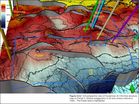
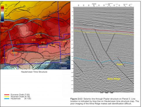
A number of leads have been identified in Parcel 3. Poplar is a large closure mapped at the Hauterivian level on the western portion of this parcel and east of the undeveloped Glenelg Field (Figure 2.4.2). The Alma Ridge at the core of this structure is poorly imaged on the small 3D survey (Figure 2.4.3). The edge of another 3-D survey crosses the Alma Ridge at this location, but also has poor imaging and makes it difficult to clearly define the deeper structures and determine the extent of mobilized salt in this area.
At deeper levels, the crest of the structure migrates south towards the center of the parcel. Closure further east along the Poplar fault near the center of the parcel may also exist but requires more detailed mapping and depth conversion.
Missisauga reservoir sands are expected to be equivalent to those found at Glenelg, Triumph, and Chebucto having good porosity with thick overlying sealing shales. This is an area with proven reservoir quality sands and gas-charge.
Shallower rollover closures at the Wyandot level may also be present with the possibility of a remobilized chalk reservoir.


