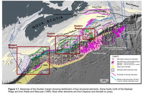
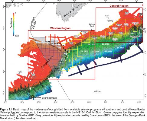
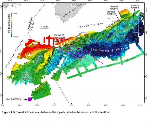
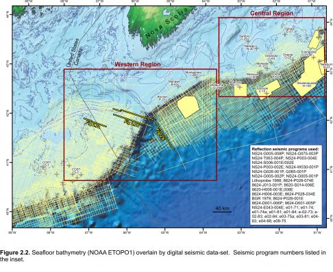
Parcels 1, 2, 3, and 4 in the NS15-1 Call for Bids are located on the outer shelf and slope of the southwestern most Scotian margin, east of the Georges Bank moratorium area and existing (but inactive) BP and Chevron exploration permits, and west of Shell’s Exploration Licences 2423 and 2429 (Figures 1.1, 2.1). The parcels sit above the westernmost parts of the Shelburne Subbasin, as defined by Wade and MacLean (1990), east of Georges Bank Basin (Figure 2.5). While numerous published reports are available for the geology of Georges Bank (e.g. Austin et al. 1980; Schlee and Klitgord 1988; Wade and MacLean 1990; Poag 1991; Poppe and Poag 1993), modern research east of Georges Bank has been comparatively meager. Using a combination of vintage and more recent 2D and 3D reflection seismic data-sets (see Figure 2.2 for data-coverage and a list of seismic programs used), the following discussion provides geological context for Parcels 1 to 4 and detailed description of several important structural and stratigraphic elements on this part of the margin.
Photo Credit: Encana Corporation


