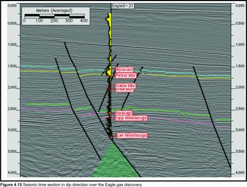
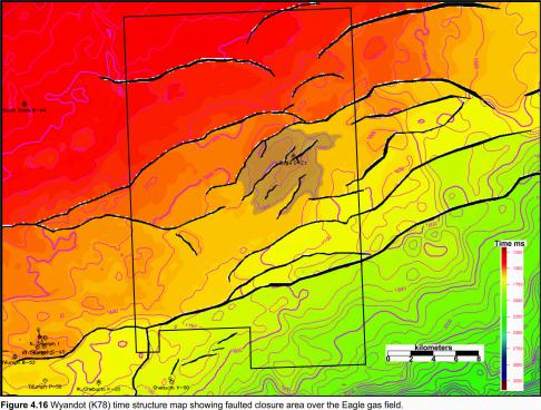
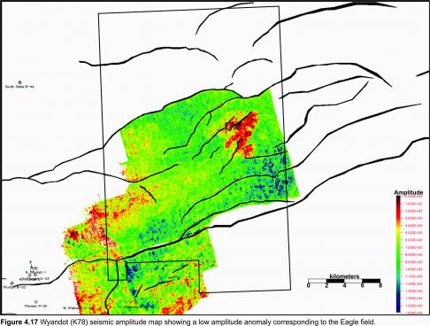
A seismic dip line through the D-21 well shows a salt cored, faulted rollover anticline with 3 antithetic faults (Figure 4.15). The structure is bounded on the north and northwest by a major northeast-southwest trending growth fault. The Eagle gas reservoir is located within late Cretaceous limestones of the Wyandot Formation. The reservoir is a thick, continuous package of limestones, marls and chalks representing deposition on a stable, shallow, open-marine continental shelf. Well data indicates that the Wyandot carbonates are generally lime mudstones that are soft, chalky, fossiliferous, pyritic, argillaceous and interbedded with marls and calcareous grey shales and mudstones. A time map on the Wyandot shows closure around a series of fault (Figure 4.16). An acoustic amplitude map shows a dimming, indicated in red, of the Wyandot reflection that roughly corresponds to the mapped closure of the gas charged chalk (Figure 4.17). This dimming may result from an increase in porosity within the chalk.
The top seal is provided by the overlying shales of the Banquereau Formation. The lateral extent of the reservoir to the east, south and southwest is probably limited by a combination of structural and stratigraphic trapping due to the generally low matrix permeability of the reservoir. The bounding faults seal as the Wyandot reservoir is juxtaposed against shales and tight limestones of the Dawson Canyon Formation.


